Distance covered today: 21.6km (13.4mi)
Last night's B&B: The Lugger Hotel
% Complete: Cumulative distance: 62.3%: 631.7km
Total Ascent/Total Descent: 892m/ 916m
GPS satellite track of today's route: Day 34(click!)
Today was in one way a repeat of yesterday, but in another way the converse. Both routes set out to reach significant promontories at about the half-way mark of each route: yesterday it was Nare Head and today Dodman Point. The difference was that yesterday the earlier part of the day was relatively easy strolling behind the great beaches of Pendower and Carne, followed by a more energetic circumnavigation of Nare Head and an explosive closure towards Portloe. Today was the opposite.The approach to Dodman Head was exhausting and then on the other side, the relentless roller coaster gave way to a much more civilised meander along the coast.
This was a good thing, because the route proved tougher than I had imagined in the planning, both in terms of distance and climb, as the stats above demonstrate. In fact there was more climbing today than on any other day of this trip so far, and by the time I reached Dodman Point I was feeling fully exercised!
In fact scrutiny of the elevation graphs of both days adds only some credence to my analysis, proving that most interpretation of exercise stress is in the head, not the muscles! Still I can only tell it like I felt it!
I did though see my first kestrel of the trip. It was hovering directly in front of me and I was struggling to get my camera in focus when it spotted its prey and dropped like a stone. I caught blue sky in the lens, but did see the bird disappear with something in its beak. I understand from a poster along the route that a kestrel can spot a beetle at 50 metres and will dive to catch it. Equally it needs to consume something like half a dozen voles a day to maintain its weight while hovering in the air-stream. Not good news for voles.
The other fascinating thing I learned today was about the relationship of the National Trust to the Coastal Path. My interest was piqued this morning when I saw an interview on TV with Hilary McGrady, the new Director-General of the Trust. She seemed to me to be a very natural communicator and I was interested to learn that she is the first non-Oxbridge DG to be appointed. Her point was that the Trust had to be for the people and most of the people are not interested just in the stately homes of the aristocracy. There are apparently twice as many members of the National Trust Charity than of all the political parties in Britain combined. Her job, she says, is to make the Trust more relevant to the average citizen of, say, Birmingham.
I have been fascinated during my walk along the Coast Path at how many of the coastal properties are actually owned and managed by the Trust. Every couple of kilometres you come across an NT sign announcing your entry to yet another of its properties, accompanied inevitably by a sign telling you how to behave.
So I've done some research! The Trust's very first coastal acquisition was Barras Nose in North Cornwall in 1897 (I took a picture of it on my visit to Tintagel) and the Dodman, which I crossed today, was given in 1919. Given the threats to the coast, the Trust stepped up its acquisition efforts in the '60s and the result is spectacular. The Trust now protects fully 43% of the Cornish coastline and 59% of the Devon coast. I am ashamed to admit that I am not a member of the Trust, but Veronica is! She hardly ever uses her membership and here I am, benefiting on a daily basis from the work of the Trust and its benefactors. I'll have to do something about that when I go home!
Tomorrow is another rest day (at last!), so no blog!

Not a good start to the day. I asked the receptionist which was the best way onto the path. She told me to go up the road, but she didn't say which way. Inevitably, I went up the wrong way.....

Looking down at lovely Portloe from the (correct) path!

That's my first objective for the day on the horizon: Dodman Point
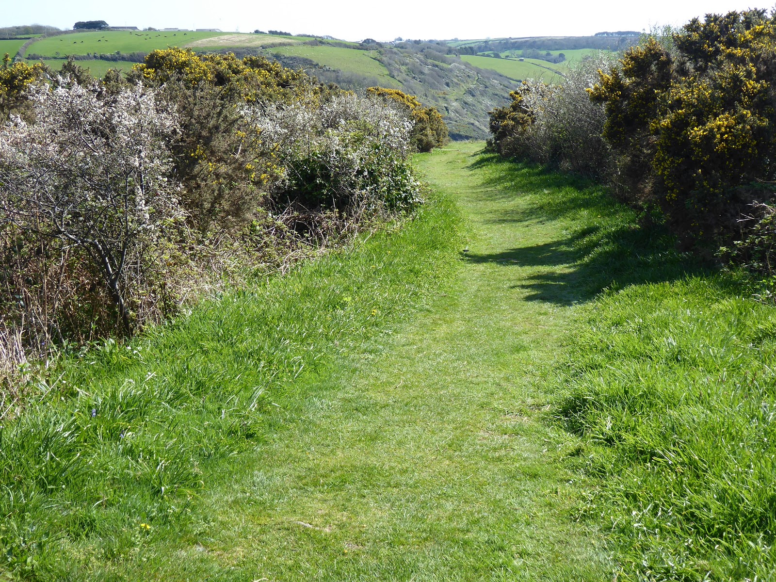
Gorgeous, easy walking on a lawned path, flanked by flowering blackthorn and gorse

And then, much tougher stuff. Ups and downs to the unspectacular West Portholland and East Portholland

Lovely waves rolling into a cove

Caerhays Castle. It was designed by John Nash in 1808. He also designed Buckingham Palace and the Brighton Pavilion

Porthluney Cove

I lied yesterday! The Lizard peninsula is just still visible on the horizon. It seemed a satisfyingly long way away!

More coastal coves at Hemmick Beach as I begin to approach the Dodman

The way is strewn with daisies, dandelions, celandines and the odd early buttercup. An absolute picture and almost out of nowhere! The sun and heat of the last two days have done it!

The cross at Dodman Point was erected by the Rev George Martin in 1896 to assist sailors with navigation and requested ultimate redemption

Looking back at the tortuous ascent to the Dodman

A Dartmoor pony for Veronica. The national Trust assured me that they are regularly checked by vets and farriers and are in the best of health. I saw a bunch of trippers trying to feed them, specifically against the Trust's instructions. I had to restrain myself from intervening!

Bow or Vault Beach. I'm pleased to see the Cornish haven't forgotten their penchant for naming things twice!

Gorran Haven appears around a headland. Time for a refreshment!

The church in Gorran Haven. The sign says that Christians have probably been worshipping here for 1,600 years. If true, that is amazing!

A lamb for Phyllis!

Portmellon in view at last

Chapel Point: three striking houses all on their own, designed by John A. Campbell and built between 1933 and 1938 of stone taken from the site.

Polkirt Beach

Mevagissey harbour

The narrow, atmospheric road into Mevagissy

Morning, Kevin!
ReplyDeleteI am envious! It looks like such a glorious day, and I can imagine skipping along that grassy lawn in your fourth photo and dipping my toes in the cool water at Porthluney Cove. I also enjoyed your photos of the architecture; I was curious about the the Chapel Point property and looking it up online discovered a real estate listing for it in 2015 and it's a gorgeous property. I hope you enjoy Mevagissy; we were here in 2007 and what I remember most is that it's one of those places where having a car is a big mistake! Thanks for the lovely Cornish lamb....baaaaa.
Now there's an idea, Phyllis. You and Rob should acquire one of those Chapel Point properties and we'll come and stay with you! And you really are right about cars in Mevagissey. They didn't figure in the town planning!
DeleteWhen I lived in the UK all those years ago, we had the Trust as a client and I spent many days photographing stately homes and gardens & interviewing custodians and in some cases owners who were handing over their properties to the trust. Good luck to the new DG changing the culture or the organisation to make it attractive to residents of Birmingham! There’s a lot of potatoes that must be removed from a lot of mouths to even make them understandable in Birmingham - and many of the properties are as far removed from daily life as are space rockets. But it’s a fine objective. i imagine à sort of Disney meets the Queen? Maybe they can do Coastal Pathway Rides? Have a happy day Kev!
ReplyDeleteYou make a very good point, Barbs, though to be fair all this acquisition, restoration and maintenance of coastal properties is a step in the right direction. Agreed, very few Birmingham residents are as nutty as your correspondent, but Brummie accents are as common on the Coast Path as plummy ones! There are also a lot of foreign accents and that helps the UK as a whole. It will though be interesting to see how she gets on. Will she change things or will the system quietly resist?
DeleteThere is no finer vista than parts of England on a fine day and your photos capture the scenery wonderfully.The trees behind the majestic Caerhays Castle are still looking wintry - I suppose understandable after the recent cold.
ReplyDeleteWe agree with Phyllis that the Chapel Point property looks gorgeous!
A few boats in Mevagiisey Harbour, but far fewer than the mass of craft in St Mawes (day 32) - when I looked at Earth View of your route, I wondered what all the specks were and close-up revealed boats - there must have been far in excess of the villagers or perhaps an overflow from Falmouth in any case it looked like considerably more boats than people!
Yes, Pete, St Mawes is a very up-market sailing centre, and all those boats are yachts. The boats in Mevagissey are proper commercial fishing boats. The geography of the St Mawes peninsula is such that it is very protected from winds and seas around the dial. This is not so for the ports which front directly onto the open sea such as Mevagissey. Here all the boats have to live within the harbour to survive. The same was true of Porthleven and most of the other small ports.
DeleteAnd yes, the flowers have exploded but it will take time for the trees to go properly green!
The Gorran Haven church has interesting architecture. It is nice to see that they can keep it open during the day. I do like some of those Cornish names, Mevagissey has a lilt to it.
ReplyDeleteHi Bridgy, I suspect everyone who lives in Gorran Haven knows everyone else, but there are lost of visitors, so your point stands! I was reading a book about Mevagissey last night, one chapter of which was devoted to explaining how it got its name. It was so complicated that I lost concentration, but essentially it is the combination of two villages which merged and the resulting village was influenced by early Christians and somehow the name emerged, quite different to those of either of the first two villages!
DeleteHow interesting! I hadn't even thought about how Mevagissey got its name, but I agree about the lilt; I've remembered it ever since the first time I saw it on the map!
Delete