Distance covered today: 24.4km (15.2mi)
Last night's B&B: Holywell B&B
% Complete: Cumulative distance: 74.0%: 788.2km
Total Ascent/Total Descent: 890m/ 974m
GPS satellite track of today's route: Day 42(click!)
Today was a good day to be alive! The weather was superb for
walking and for my walk in particular. The route was one of the most
spectacularly satisfying of any of those I have done on the Coast Path and
although arduous in places, I just didn’t mind. Perhaps I was energised because
this is the last day of the current trip? Or maybe it was because the condition
of the path was simply excellent and in places so magnificently engineered that
I was really amazed. The brilliant weather conditions may also have helped. For
most of the day, I had a chilly north-westerly wind blowing me along from
behind as I headed south east. As I rounded Bolt Head, the path wended its way
below the upper extent of the cliffs, so I walked along in windless conditions.
Meanwhile the sun shone strongly all day long. These were extraordinary
conditions! Where have I experienced such warm, strong sunshine accompanying
such a chilly wind? Betty’s Bay came to mind, and in a strange way, that
enhanced my enjoyment.
The day started unpromisingly enough with a rearing and
plunging road walk along those dangerous Devon roads, but two things surprised
me. The homicidal drivers of my earlier acquaintance on LEJOG seem to have
slithered off elsewhere. I met only genuinely careful and good-tempered drivers
who invariably stopped and had to be waved on vigorously as I shrank against
those solid clover-covered walls. Then, out of the blue, I came across a
passing place which I recognised! How completely incredible! I didn’t even know
I had been on that road before, but the evidence was there. Once upon a time,
Veronica and I were driving down to Bigbury and a homicidal maniac forced us
off the road resulting in a fatally punctured tyre. We stopped at this very
passing place to replace it with the spare. I know because I recognised a rock
on the side of the passing-place where I had rested the spare as I wrestled
with the bolts on the injured wheel. What are the chances?? OK, so it’s not the
same as discovering Australopithecus Africanus, but recognising an
inconspicuous passing-place on a road down which you thought you had never been
before was way up there for me!
My next task was to cross the River Avon by ferry. In
planning this trip I had understood that, rather eccentrically, the ferry
operator didn’t work on Sundays, a day which I would have thought would be
quite good for him in the tourist business, but as I Iater discovered, he’s
been operating this ferry for twelve years, so presumably he understands his
market. I had had to adjust my entire schedule to accommodate the Sunday
curfew! Also, a little more
controversially, he operates his ferry from 10am to 11am and from 3pm to 4pm,
and that’s it! The business of hailing his ferry is also a little old-world.
The instruction is to wave your arms vigorously and shout. There is a mobile
number, but no signal.
When I arrived, I discovered a rather taciturn and somewhat
morose, part-time, long-distance walker trying to attract the ferryman’s
attention at five minutes to ten. I told him my life history and he grunted.
When we eventually successfully reached the other shore, he disappeared with
alacrity and I was pleased to see him go, but unfortunately he was walking too
slowly for me. I could see he was doing his best to outpace me and decided that
only thing to do was to speed past him, wish him well and disappear up the
path. I didn’t see him again. Most satisfying!
Once I had circumnavigated a golf-course and a rather
forgettable village called Thurlestone, the magic began. I passed two little
villages named enigmatically Outer and Inner Hope and rounded Bolt Tail. The
path was sublime, the views back along the coast, magnificent. True I had to
scale Bolberry Down, but thereafter the National Trust has constructed a path
that is literally wheelchair friendly. It is another path worthy of a special
visit for those less keen on the roller coasters.
As I approached Bolt Head, the Path remembered itself and
bucked and reared as becomes it, but shortly afterwards, I was entertained to
the best bit of cliff-walking that I have experienced in the UK, a path round
the vertical cliffs of Sharp Tor. Inevitably, the path was cut by a toff in the
nineteenth century to give access to Bolt Head and is known as the Courtenay
Walk. It is simply magnificent!
As I approached Salcombe, I passed the South Sands Ferry,
which I had planned to take into Salcombe as a reward for the end of this trip,
but I was enjoying the walk so much that I decided to walk into town instead, a
decision which I immediately regretted as the road bucked and reared just as
much as the path and my B&B turned out to be at the top of the cliff! It
did allow me the pleasure of passing the castle, very near where my very good
friend, Richard B was born and I thought of him fondly as I passed.
I should cease and desist at this point, but not so fast. Here is a graph I have constructed showing
the progression of Lumpiness Quotients as I have completed this trip. OK, so its what I do; so humour me!
It turns out, referring back to the blog texts for the days concerned that the lumpiness quotient is a reasonable indicator of the individual day's difficulty. I need to do the analysis over the whole of the Path to see if this remains true, but it seems to me that as time passes on a particular trip, my sense of enjoyment increases, irrespective of the lumpiness quotient. Is this because I get fitter as I get to the end? Or is it just because I just get into the routine and all subsidiary issues start to fade?
I wonder if I will ever know? Thank you so much for your company and I hope to accompany you next year on my final trip of the Coast Path
The scene of the blowout. It's that stone on the side at the top left that gave it away!
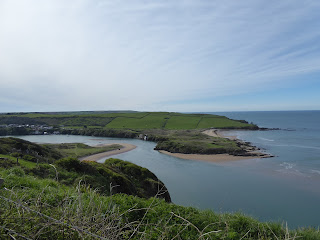
Burgh Island from above
The Avon River estuary. Ferry required!
And here it is!
Last view of Burgh Island from the East
A lovely arch rock
An impressive 85 metre bridge across a waterway esteemed for its birdlife
There were a number of birders watching, but I was in a hurry!
The Devon Flag. Nationalism breaking out everywhere.....
An interesting inscription. I didn't know that the Royal Family had been Masons
An incredible piece of natural art. Who is that guy?
Gorgeous cliffs in the sunshine
Bolt Head ahead!
A first look at the Salcombe Sound
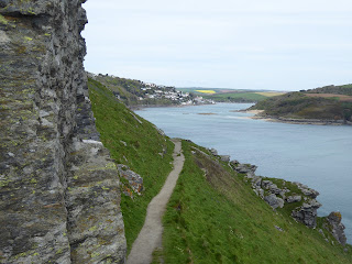
And then the incredible Courtenay Path. Look hard and you will see the path curving round just below the vertical slope. It was awe-inspiring!
Looking back towards Bolt Head. A tranquil sea in the lee of the brutal northerlies
The Courtenay Path continued
And then down a cultured path, a first view of Salcombe
??
Through a forest flanked by wild garlic
The South Sands Ferry with its unique tractor assisting passengers to board. I resisted its blandishments and walked up and down into town!
The Salcombe Castle, or Fort Charles, was the last place to hold out in favour of King Charles I against the Parliamentary forces of Oliver Cromwell, especially after Plymouth had opted for the Parliamentarians. Ultimately, when all hope was lost, the garrison was allowed to withdraw with their colours flying.


