Sunday, 15 May 2016

Day 4: Combe Martin to Woolacombe

Weather: Wall to wall sunshine with chilly westerly; perfect
Distance covered today: 17.8km (11.1mi)
Last night's B&B: Mellstock House
% Complete: Cumulative distance: 7.9%: 79.8km
Total Ascent/Total Descent:  623m/446m
GPS satellite track of today's route: Day 4 (click!)


In my guidebook, it declares a list of dos and don’ts for safety on coastal paths. The very first rule is don’t walk on your own if you can possibly help it! Rubbish advice! The way I felt today, I would simply have flown if I had fallen off a cliff. What a difference a day makes! I think it was that dratted Great Hangman that did me in, (which I suppose hangmen really should). Today I would have been insufferable company, positively singing my way along the most spectacularly beautiful coastline I’ve seen on this trip so far. Even when the coast was rudely interrupted by a necessary diversion to my B&B miles inland, I wasn’t fazed.

I had identified a disused railway, the old London and South Western Railway line from Barnstaple to Ilfracombe, which took me on the most beautifully prepared cycle track right to the very door of tonight’s B&B. I passed seas of wild flowers; Red Campion, Wild Garlic, Dandelions, Ox-eye Daisies, Bluebells, Whitebells, Sea Campion, Gorse, Cow Parsley and my beloved Stitchwort, some of which seem to do less well at the seaside. As is clearly illustrated in the elevation profile below, the track climbed steadily all the way to the B&B, and I was interested to read that once upon a time, the gradient from Ilfracombe Station made it the hardest standing start for conventional steam engines in the country. It required two engines, one to push (the “bank”) and one to pull (“the pilot”), reminding me of Grahamstown station in the Eastern Cape of South Africa.

At its high point in 1939, just before the war, the station at Ilfracombe accommodated an astonishing 10,000 people on summer Saturdays, requiring at is zenith 26 trains travelling in each direction. In the late fifties, the line’s fortunes declined and it was “singled” in 1967, just to be closed, probably as a result of the Beeching closures, in 1970.

Those changes in fortune seem to me to be reflected in the architecture of Ilfracombe. Even at a distance, its Edwardian Terraces have grace and elegance, as do many of the older buildings. The town’s increasing popularity amongst holiday makers before the 2WW must have led to a building boom, with all sorts of rubbish being thrown up in a huge hurry to accommodate the holiday makers.  Recently, the efforts of the North Devon County Council to reverse Ilfracombe’s declining fortunes are also evident, though the seaside retains all the tat so reminiscent of so many British seaside resorts.

One major dissonance with all this worthy effort is the extraordinary decision to accept Damien Hirst’s remarkable sculpture of Verity which adorns the focal point of the harbour. I confess I had never heard of it, and when I saw it from across the bay, I immediately detoured to inspect it. Four things were immediately apparent. All the tourists in the area, and there were hundreds of them, were studiously ignoring it. I asked a few about it and they professed embarrassed ignorance. The second is that it so dominates its site that absolutely no visitor to Ilfracombe can possibly miss it. I understand from Google that it is taller than Antony Gormley’s “Angel of the North”, despite being located in a much “smaller” space. Thirdly, there is absolutely no information about it in the area; no information posters, no title, no nothing, not even an attribution.  The last extraordinary thing is that Hirst, who lives in and owns a restaurant in the town, has only lent the statue to Ilfracombe for 20 years! It is certainly, as with so much else of his, a revolutionary piece of work. I leave you to judge…

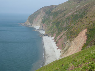
All this industrial, architectural and arty speculation has somehow missed the point of this blog! It was the scenery before I reached Ilfracombe that blew me away today. True there was a fair amount of up and down, but the effort/reward ratio was hugely positive.  The views of those little coves, bays and promontories, all bathed in beautiful sunlight amidst the bluest of seas was all I had been led to expect, only better. Finally, the mist had cleared sufficiently for me to see Wales across the Bristol Channel. According to a toposcope I found on the path, I was looking at the hills behind Amroth and Tenby, the very place where I started my Pembrokeshire coastal odyssey. A little later, I was staring open-mouthed at a staggering view when I heard a curious German/American “Hullaw” from behind. It was indeed Laura, who professed to have been so damaged by the Hangman that she had needed extra recuperation time in bed this morning. After a pleasant interlude, we parted soon afterwards amidst hordes of day-trippers, choosing different routes into Ilfracombe.

I chose the longer seashore route and I contend that mine was far more attractive!

In the light of a bright new day, Combe Martin seems somehow much more attractive!

A surprising multi-coloured giraffe and offspring along the way on a porch

Profusions of Wild Garlic

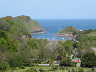
My first view of the lovely Watermouth Bay

Looking back towards Combe Martin over a florious little cove, unreachable by land

Strange people doing strange things, paddling large surfboards. Why?

Watermouth Castle, a Victorian Gothic imitation which is now a theme park

The entrance to Watermouth Bay, where during the war, the allies first perfected a trans-channel fuel supply pipeline to Cardiff as a successful prototype for fuel provision to the Allies in Europe after D-Day (Operation Pluto: "Pipelines Under the Ocean")

Sea-Campion

My last view of the Great Hangman (the highest point in the distance)

Samson's Bay and Rillage Point

Fishing for pots, presumably with stuff in them(!)

And that, finally, is Wales; just about visible

A view of Ilfracombe from the top of Hillsborough


Turns out this is the last view of the Great Hangman. He does persist!

Traditional rowers

The Edwardian terraces of Ilfracombe

A view across Ilfracombe working harbour

The extraordinary Verity by Damien Hirst, a very pregnant woman, with contents of her womb clearly evident, holding a sword and the scales of justice and standing on a whole lot of law books!

Ilfracombe has the second largest tidal range in the UK. The architects have built this quay on a slope , so you can always get to the water's edge. Innovative!

A tunnel on the Barnstaple to Ilfracombe Railway, showing the shut-off second line, with the first converted to a cycle track


Saturday, 14 May 2016

Day 3: Lynmouth to Combe Martin


Weather: Grey to start then glorious sunshine and cool breeze
Distance covered today: 23.8km (14.8mi)
Last night's B&B: Bonnicott House
% Complete: Cumulative distance: 6.1%: 62 km
Total Ascent/Total Descent:  1047m/1057m
GPS satellite track of today's route: Day 3 (click!)

Stop the presses!  Today I finally met another long-distance walker on the South West Coast Path! You will not, though, be surprised to hear that she turned out to be a foreigner!  Her name was Laura, and she talked in a curious American accent which I immediately assumed was Canadian; this generally being my experience on these walks. I was embarrassed to learn that she was in fact German. I would have thought I could tell the difference, and as I was falling over myself in apology, she tried to help me feel better about it all by saying that she had in fact learned how to speak proper English in the US. Given the depth of the hole I had dug, I chose to let that pass…..

She was a delightful young lady, but somewhat taciturn and perhaps a little alarmed at the barrage of enquiry emitting from this grey stranger, panting up the combesides (a new word that I have just coined, destined to produce a nervous tick in any walker who hears it uttered, but more of that later).  I managed to establish that she works for the Deutsche Bundespost, but that she has recently received a bursary to study medicine. She hopes to start studying soon in Hungary, which I found mildly surprising.

She also told me that she had “fallen in love” with the long-distance paths of Britain. This produced a predictable soliloquy from me. It must have alarmed her further, but by now I was panting up a particularly steep combeside, and after solicitously enquiring after my health through my rasping breaths, she smoothly accelerated away.  A little later she opted to take an alternative route along the SWCP, which my own researches had revealed would take longer with little profit, so somewhat to her surprise, I leap-frogged in front of her, and she was mightily surprised and probably even more alarmed to find me ahead of her after the paths had re-joined.

This time we did walk together for a while, but I realised I was doing most of the talking, and felt that this whole thing was not going according to plan, so I invited her to press on, which she did, accelerating up the combeside from Sherrycombe to Great Hangman and staying five minutes ahead of me for the rest of the journey.

Meanwhile both at the start and towards the end of the walk, there were plenty of day-trippers on the path, probably because it was Saturday, but also, according to some of them, because both ends offered some spectacular scenery.  Certainly the exquisite tarred path to the Valley of the Rocks enabled less capable people to enjoy the views, but by the time I had passed Lee Abbey, I was back on my very own path. Towards the end of the day’s walk, Great Hangman has the highest vertical cliff face to the sea in Britain at 250m (800ft), not that one can approach that face in any safety. The cairn at the top of Great Hangman is 318m, and one approaches it from a combe just 25m above sea-level. Half-way along the day’s path, one has to cross one of Britain’s steepest valleys, cut by the Heddon River. No wonder the knowledgeable locals avoid these things (there is a carpark and a pub on the road right at the entrance to the valley, so that folk wanting to go to the beach just walk along the river at sea-level). How come I only find out these things while I’m doing them!

You may have noticed above that the vertical climb and descent exceeded 1,000m (3,300ft) for the first time today, very much the result of those combesides! It was truly a punishing day. Crosscombe Lane (appropriately named) provides locals and tourists alike with easy access to parking places relatively close to all the beauty spots and beaches, without having to make much effort.  After the walk while I was buying a light refreshment from a young man in a convenience store, he wanted to know why I was looking so clapped out. I drew myself to my full height, told him my quest, and he threw back his head and roared with laughter. Why, he demanded to know, would anyone do what I had done, when one could access all the best bits by car. The way I was feeling, I couldn’t help thinking he had a point! Seeing my shock, though, he relented and admitted that he had climbed Great Hangman. I muttered that this was a start, paid and left.

Yet after the little gems of yesterday, Lady Lovelace’s tunnels, Porlock Weir and Culbone Church, today was curiously empty; just a very hard slog across unrelenting terrain for not very much reward. I had this feeling especially when I finally made Combe Martin, a rather run-down resort, with little of the charm of Porlock or Lynmouth. Maybe I was expecting too much, or maybe I was just missing Veronica……


Another view of charming Lynmouth

The tarred path along the cliff to the Valley of the Rocks

Castle Rock

Laura powers off with her full pack and camping gear

I thought I only had to beware the Beast of Exmoor (a possibly mythical, panther-like creature who ripped the throats from over 100 sheep). It seems I have also to beware of Fathers with children!

Lee Abbey, a Christian community centre, in its exquisite location

The mist is slowly lifting over the coast. No sign of Wales yet!

I am joyously reunited with the glorious crenelated bridges of Devon!

A view back down the coast from West Woodybay Wood

The infamous Heddon River!

Heddon's Mouth Beach from the top of the valley

Jet-skis below the cliffs. This is a highly zoomed photo, yet I could clearly hear the two people on the bottom boat talking to each other. It must have funnelled up the cliff face

Gorse still life at cliff's edge

That's Great Hangman ahead. From the shore, one can't see the sheer cliff

My backpack and sticks against the Great Hangman cairn, proving I wuz there!

The beach in Combe Martin. Underwhelming....


Friday, 13 May 2016

Day 2: Porlock to Lynmouth

Weather: Blazing skies with heavenly, cool north-easter 
Distance covered today: 22.3km (13.9mi)
Last night's B&B: Seaview
% Complete: Cumulative distance: 3.2%: 38.2km
Total Ascent/Descent today:  846m/872m
GPS satellite track of today's route: Day 2 (click!)

If yesterday was a canter, I took today at a steady trot! I was aware that the demands of the day would be almost double those of yesterday and I did feel tired last evening. I was not disappointed! The distance wasn't the issue; it was the rise and fall of the cliff path. I am slow in many things, but it has taken many years of map-reading and long-distance walking for me to realise that it is not easily possible to estimate total ascents and descents on paths that run along cliffs. In retrospect, the reason is obvious! As the contour lines on the map crawl closer to each other and coalesce into a brown smudge, a public path drawn parallel to them appears to follow a specific contour. It may not! By shifting tenths of millimetres on the map in either direction, the path may ascend or descend tens of metres!

It was just so today! In fact,with the exception of a blissful, sylvan idyll along the cliff through Culbone Wood, I was pretty much tramping up or down the entire time! It is also fascinating (to me!) that even plotting the route on a OS digital map doesn't solve the problem. My OS predicted total ascent today was 1,113m, yet as you may have seen above, in practice, I only ascended 846m. The reason, in retrospect is clear; when you plot a digital route on a map, you draw straight lines between waypoints, but by their nature, they are at the extremes of the curves on the map and hence may very much be higher or lower than the actual path. It seems so obvious now!

I appreciate that I may be the only participant in this blog who is even the slightest bit interested in the foregoing and so to every other reader I render my humble apologies and suggest only that when the thighs are screaming and the heart is pounding, the brain tends to want to find an explanation!

That said, today's walk was indeed interesting beyond the cliffs, or perhaps because of them. After leaving the impossibly quaint villages of Porlock and Porlock Weir, I was thrown into an environment redolent of the distant past. I passed through tunnels built by Lord King, the husband of the only legitimate daughter of the poet Lord Byron, Ada Countess Lovelace. He built Ashley Combe to please his wife, influenced by the fairy castles of Italy. On the other hand, the tunnels were built so the residents didn't have their views interrupted by the comings and goings of tradesmen on the estate. The fabulous residence is no more; the tunnels still exist! A moral, perhaps?

As I travelled further, I came on Culbone Church, England's smallest complete parish church, meriting an entry in the Guiness Book of Records. More importantly, it was counted in the Domesday Book. Celtic missionaries from Ireland and Wales travelled along this path from about the late 6th century onwards, leading to a revival of Christianity in England. I may have been going in the opposite direction, spiritually and directionally, but I was moving in august company!

Culbone church is surrounded by a tiny community accessible only by the roughest 4WD track, and beyond lay the true coastal wilderness on the edge of Exmoor, with no civilisation in sight for miles. I got to thinking about the juxtaposition of historical events in a given geography and how even in one's own life, geographical changes can effect perception.

Memory is a strange thing. I have no doubt that neuroscientists and psychologists will have much to say on the subject, but as I traverse these alien lands, finding so many things in common with previous experience, and so much completely new to me, I have been thinking about it all in a much wider perspective, or should I say, longer.

As I have sometimes explained, my relationship with this land is complicated. I first arrived here when I was three years old, and my earliest memory is of the sick bay on the MV Edinburgh Castle, where I was quarantined with Chicken Pox! We lived in England (and Ireland) for four years and I left for South Africa with a broad Yorkshire accent. I have since returned to live here on four separate occasions, all of them, except the last, truncated for a range of practical reasons.

So my memories of England, like the history of these cliffs, are specific and time-related. I have found in innumerable conversations with many people that my recollections of the past in these parts are at variance with theirs, and I may have stumbled on an interesting interpretation!

It seems to me that they are looking at a video and I am looking at a series of stills! I was talking to Rosie last night in the pub, telling her that I remembered individual speeches by Arthur Scargill in the 1985 miners’ strikes and the response by Ian McGregor, head of the Coal Board. Few of my contemporaries even remember his name, let alone his role! I remember the excitement around Steve Davis winning the world snooker championship in 1983 and 1984 as if it was yesterday, yet no-one I know could even guess those dates.

Of course, what I am saying is obvious! If you have a short immersion in a bit of the history of a particular geography, it sticks! If you are constantly moving in time in the same place, everything blurs. So when I talk of the past to people in any of the countries in which I have lived, I am using a completely different perspective. My still photograph is detailed and specific; theirs is a mosaic moving in time. Neither of us have any objective view of reality.

And so it is with my walks. I take still images along the way, which I delight in appending to these blogs. My own perspective, though, is a kaleidoscope of moving images. A happy blur!

Neither is the truth.


Leaving my love in Porlock

A good day for a regatta off Porlock Weir

The lock in the quaint village of Porlock Weir

Possibly the most impressive toll booth I have seen anywhere, charging vehicles to access the Worthy Toll Road

Lord and Lady Lovelace's tunnels

Every time there is a landslip, it involves a major diversion uphill, followed by a similar painful descent! There were lots of landslips!

Approaching the isolated Culbone community,

I encountered this lovely, old fellow playing his guitar to himself in a secluded, sheltered, sunlit spot

Culbone church

Its fascinating font

The church from the graveyard

The lovely path through Culbone Woods

There were innumerable combes along the path. I had expected them to be in full spate, after the recent heavy rains, but the water had already cascaded down the cliffs and they were just beautiful murmers

Gorgeous deciduous forest,

followed by much more sombre conifers; darker, quieter, greyer, somehow sinister!

The extraordinary entrance to another privileged estate, Glenthorne House 

Foreland Point comes into view in a gap through the trees

A curious, unexplained edifice along the path


Rhodies; presumably escapees from Glenthorne

That's a 250m vertical drop to the shore. Scary at times...

Then, a spaceship in the sky! Actually, probably a ferry through the mist, with no horizon and no view of Wales

Suddenly, the terrain changes dramatically! A comfortable path, but yet another climb!

21st Century grave-robbers!

Looking back on Sillery Sands

Through the Whitebells to Lynmouth

Quaint little Lynmouth

The intriguing, water-driven railway escalator from Lynmouth to Lynton

Filling its water tank to propel it downhill, while raising the other empty car upwards. Ingenious Victorian engineering!